
May 2011
Comment is Free
Friday, 27 May, 2011.
A warm welcome to the many people who have discovered the British Landscape Club from the Comment is Free section of the Guardian website. We hope you enjoy the site after reading the piece on our glorious landscape’s heritage penned by the BLC’s Ian Vince yesterday.
Comments
Geology can be beautiful
Thursday, 19 May, 2011. Filed under: Merely picturesque...
We’re straying from the British landscape for a moment to look at how beautiful geological maps can be. I’m indebted to the website of Pruned which has extracted these maps from enormous PDF archives of the original reports.
In 1944, Harold N Fisk prepared a report on his geological investigation of the lower Mississippi River valley. The Mississippi - the fourth longest river in the world - ends as a delta, where it dumps amazing quantities of sediments into the Gulf of Mexico. Before it gets there, however, it has a long and rather ornate meander along the border of the American state that bears its name. Slow meandering rivers alter their flood plains perhaps more rapidly than any other alluvial process - and this can be seen in Fisk’s rather rococo-looking maps. Baroque curves lend an almost art nouveau quality to these maps. Proof, if it were needed, that art really does reflect life.
.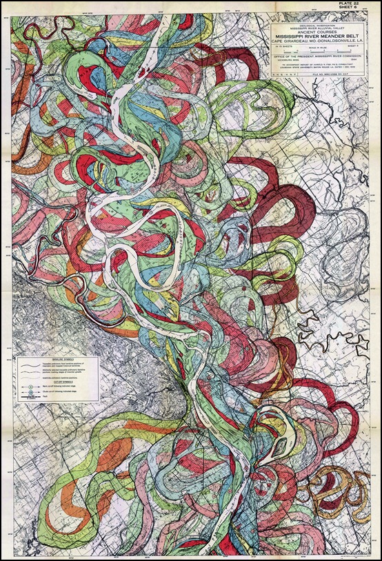
Layby of the Week: Llyn Cwm Bychan
Monday, 16 May, 2011. Filed under: Landscapes | Views & Scenery
View Larger Map
If your browser does not support Google Earth’s plug-in, you’re out of luck if you’re waiting for the Google Street car to arrive - this spot is simply too remote. Fortunately, the British Landscape Club have got there before you.
At the head of a remote valley and at the heart of the Snowdonia National Park, this Welsh lake sits at the centre of an eroded away dome - the Harlech Dome - of buckled rock that once bridged Snowdon in the north to Cader Idris in the south.
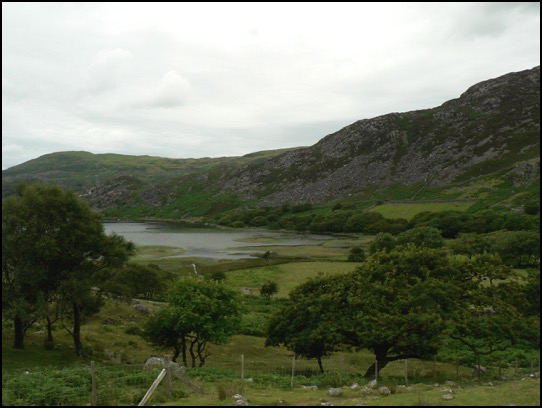
The lake is fed by the Afon Artro stream, the valley of which provides a mean transport corridor, enough for a hairy single track most of the way up from the village of Llanbedr on the coast road near Harlech. There’s a full account of its wonders in the Club manual, The Lie of the Land by Ian Vince, but all you need to know is that there’s a car park, a portaloo and moments of unfettered wilderness and blissful peace around this amazing spot.
Layby of the Week: Silbury Hill
Friday, 13 May, 2011. Filed under: Views & Scenery | Landscapes
View Larger Map
If your browser does not support Google Earth’s plug-in, here’s a real view of Silbury Hill, taken from just down the road by the Google Street Maps car.
View Larger Map
Either way, it’s an impressive structure - Europe’s largest man-made hill, it rivals some Egyptian pyramids in size and was built over successive generations from about 2400 BC. It is located in a landscape of dip and scarp, gently undulating chalk downs occasionally punctuated by imposing escarpments.
The recently synthesized view is that Silbury Hill, successive excavations of which have yielded no burials, was constantly tinkered with by our Neolithic ancestors as a kind of devotional labour, perhaps commemorating their ancestors who laboured for thousands of years building a ritual landscape in and around nearby Avebury, the site of the largest henge in the world - itself a devotional labour of epic proportions.
There’s a layby and viewing area a little to the west on the A4.
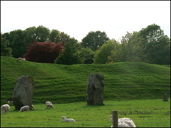
A view of a tiny part of the henge at Avebury.
View Larger Map
An aerial view.