
Glacial
Beside the Seaside
May 2013
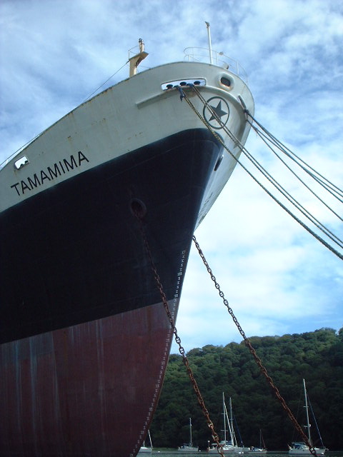
The Ukranian-crewed cargo ship, Tamamima, slowly rusting in the upper reaches of the Fal Estuary, close to the King Harry Ferry. More information on the Tamamima can be found here
While the rest of this special edition of the magazine takes to the canals and rivers of Britain, we couldn’t let the month pass without a look at the landforms that are found next to Britain’s most important waterway – one that you’re famously never more than 70 miles or so from in the UK – the sea. At nearly 20,000 miles long and formed from countless permutations of geology and topography, there’s a variety of features to see along the coastline of Britain.
Having said that, there are parts of Scotland that appear to have borrowed Nordic landforms – its north and west coast are punctuated by steep glacier-gouged fjords; each U-shaped valley terminating in sea lochs like Loch Broom by Ullapool or the glorious Loch Etive a few miles north of Oban. Although not as forbidding as their Norwegian counterparts, Scottish fjords share a heritage with the mountains of Scandinavia that goes beyond their glacial origins; they are part of the same mountain range – eroded to a fifth of its former height and torn apart by the same tectonic processes that opened up the Atlantic Ocean, while the rest of the range forms the Appalachians of the eastern USA.
At the other end of Britain, the drowned valleys or ‘rias’ of Cornwall and Devon are stunning examples of what happened when the glaciers melted. The rise in sea level – between 100-120 metres – inundated coastal valleys from Milford Haven in Wales around the coast to Southampton Water and the Solent. Among them, the Carrick Roads at Falmouth is the third deepest natural harbour in the world (after Sydney and Rio de Janeiro, since you ask), while five miles upstream and to all intents and purposes in the middle of the countryside, the channel is still deep enough to mothball container ships next to the chain-link King Harry Ferry. Despite the incongruity, like other rias – the Helford, the Fowey, the Tavy, Tamar and Dart, sylvan valleys with woods to the water’s edge and the odd bottomless boat slowly melting back into the river – the Fal maintains an air of tranquility.
Further east, Dorset’s Jurassic Coast displays a stunning set of landforms made by differential erosion; headlands of harder rock than the bays they frame, arches, sea-stacks and coves, but its most striking feature is Chesil Bank, an 18-mile long barrier beach that sweeps into the base of the Isle of Portland. It was originally described as Britain’s largest tombolo – a spit formed by refraction of currents around an island – but geomorphologists have changed their minds about that and say it only looks like one, transferring the honour further north among Shetland’s fjords – or voes – to the sandy tombolo that connects St Ninian’s Isle to the Mainland.
Comments
Snow Business
January 2013
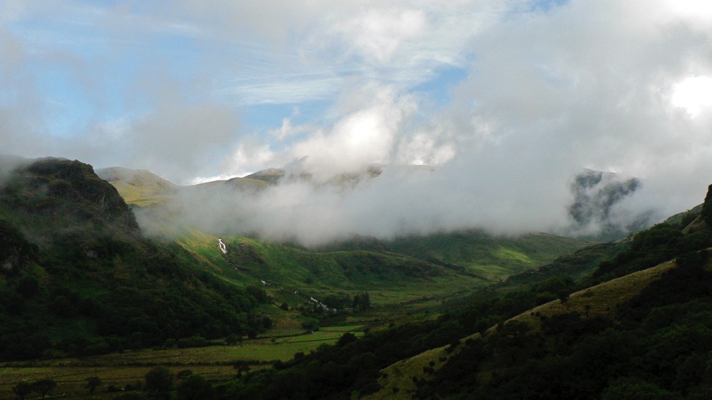
As the mid-winter celebratory twink and glitter passes by and the season threatens to throw its worst at us in the shape of a cold snap or two, it’s a good time to consider how our landscape has been shaped by ice and snow over our long history. Most of us will be familiar with the U-shaped valleys of the Lake District, Snowdonia and the Scottish Highlands, gouged out by glaciers during the last ice age and hammered into our consciousness by geography lessons since time immemorial, but they are not the only effect of glaciation which, like love, changes everything.
Every part of Britain has been affected in some way by the various glaciations of the last two million years. When glaciers tower to 800 metres, as they did during their most recent appearance between 10 and 20,000 years ago, it should come as no surprise that the features they shape are of a similarly colossal scale, but even a periglacial climate creates huge features in the landscape and their effect upon our countryside is all around us, no matter how far north or south we are.
At 100 metres deep, the Devil’s Dyke, just north of Brighton is the deepest dry valley in the world and its creation was a consequence of what tundra does to porous rock. Situated on chalk, a rock that usually has the porosity of a sponge but which became frozen and impermeable during the last ice age, the area would nevertheless have enjoyed the briefest of Arctic summers. Warm enough, perhaps, to thaw the chalk nearest the surface, which would be sludged away by the meltwater from the snowfields, leaving frozen, impermeable chalk to be eroded by a great meltwater river.
Further north, at the boundary between the ice and tundra, huge mounds called moraines were left at the snouts of glaciers and the most impressive of these forms the Cromer Ridge in North Norfolk, a nine-mile line of hills over 300 foot-high made from clay and boulders bulldozed up from the floor of the North Sea.
But what of the land that was ground down to be eventually deposited as irregular blobs on a landscape hundreds, if not thousands, of miles away? Aside from U-shaped valleys, the most famous outcomes of glacial progress are the whale-back hills known as drumlins. Rounded hills with ‘blunt’ ends that face the origin of the glacier and a long tapered tail on the lee side, drumlins often occur in swarms and form what is termed, rather descriptively, a ‘basket of eggs topography’. There’s an excellent set of them in Ribbleshead in Yorkshire, but since there are 8350 of them in Britain, it might be worth a trudge out in the snow to find your own.