
Natural Landscapes
Behind the Seaside
July 2014
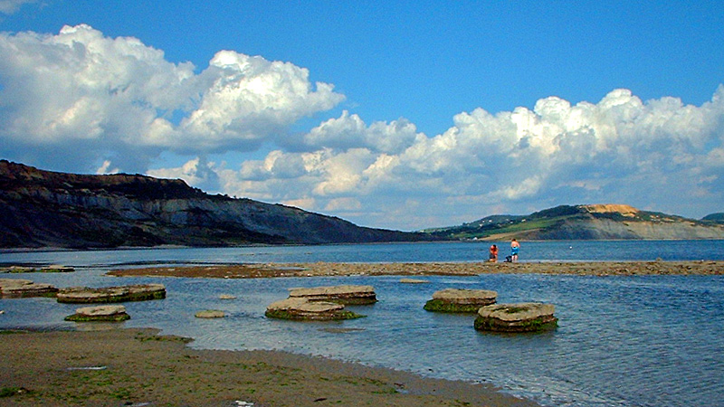
Golden Cap, as seen from Broad Ledge at Lyme Regis. © Ian Vince
As July advances, more and more of us make a bee-line for the beach to enjoy a day beside the seaside, but there’s more to the coast than just sandcastles and ice-cream cones (obviously important as they are). The sea is endlessly fascinating – especially now it has calmed down enough to stop taking huge chunks out of the shoreline, as was the case for most of the winter – but there are interesting details to note when you turn around and appreciate the hinterland, because for most of our islands’ 6000 miles of coastline, you’ll be looking at a cliff.
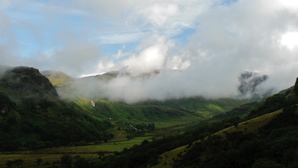
The cliffs around our shores tell us a lot about the processes that have shaped our islands and even a cursory study of the various forms they take can be fascinating. Cliffs are usually the products of gradual erosion but sometimes can also be the scene of extraordinary rock falls and landslides and nowhere are there better examples of this mix than the south coast of England.
The highest cliffs on the English Channel are those of Hardown Hill, near Charmouth or, to use its more celebrated name, Golden Cap, which stands at 191 metres – around 637 feet above the beach. At the mid point of the Jurassic Coast, the area’s geology makes landslips and rock falls common, especially after wet weather. Landslips occur when a porous layer of rock – sandstone, chalk or limestone – overlie an impermeable layer, usually of clay. The water percolates through the porous rock and then lubricates the top of the clay until the rock on top slides away. There’s a spectacular example of a landslip between Lyme Regis and Seaton, halfway up the cliff. A five mile-long coast path that hugged the ‘undercliff’ here formerly ran all the way through this NNR, an amazing landscape known locally as the Elephants’ Graveyard, but it’s now closed near Culverhole Point because of further slips. A there-and-back expedition’s still possible as of writing, but see southwestcoastpath.com for the latest news.
Rock falls are the product of more gradual processes than landslips and part of the evolution of the coastline which forms caves, arches, stacks and stumps in the piecemeal retreat of the cliff-line. Caves form when wave action erodes away a weakness in a cliff and when caves are on a headland – like those along the coast around Lulworth Cove – the erosion can work all the way through to make an arch, like the famous formation at Durdle Door or the Green Bridge of Wales on the Pembrokeshire coast. When the arch roof collapses, a stack remains and when the stack is undercut it leaves a stump, forevermore covered at high tide.
Comments
Beach Landforms
February 2014
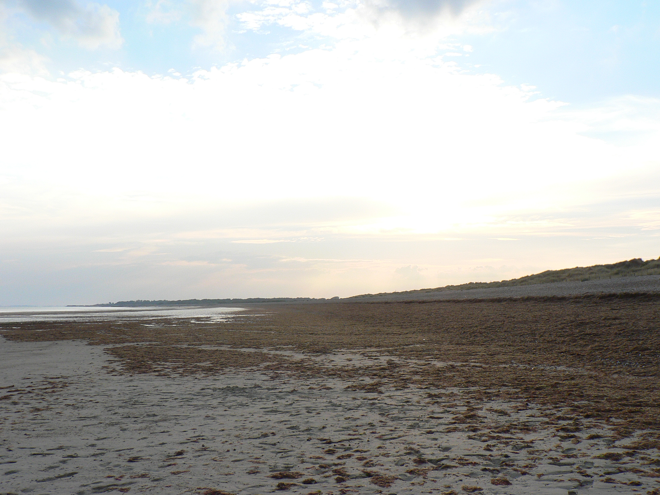
There’s nothing better at this time of the year than a walk along a breezy beach, to blow the cobwebs out of your brain. Aside from its potential to refresh, however, a beach is a unique environment, not least because it is where the normally slow processes that form landscapes occur comparatively quickly, rather than in ten million year blocks of deep time.
While even an ice age takes thousands of years to rise, subside and do its worst, beaches are the scene of constant renewal, with every wave that breaks on the shore adding and removing material. The cumulative effects are revealed over a year, a decade or a century, but in extreme conditions the coast can change even quicker; a storm can create or destroy entire landscapes before your eyes.
The main culprit behind all the heave-ho up and down the beach is longshore drift, a process where sediment-laden waves, blown by prevailing winds, hit the shore at an oblique angle and create a ‘swash’. Gravity then pulls the water, pebbles and sand back down the beach’s steepest gradient, generally at right angles to the shoreline. The passage of every grain of sand describes a zig-zagging, sawtooth pattern along the beach until it reaches another current, an obstacle like a groyne or a headland where the coastline changes direction.
Where the angle of the shore changes, the strength of the longshore current dissipates and drops the sediment, which build up to form a sandbar or spit. One of Britain’s best examples is at Orford Ness in Suffolk; you may be familiar with its elbow-like form from maps but, thanks to medieval cartographers we know it has assumed all sorts of shapes over the years, often growing over a metre a year.
Diffraction of waves around a spit leads to hook-like sandbanks – good examples abound on North Norfolk and Solent coastlines – but where they diffract around an offshore island, tombolos form. St Ninian’s Isle off Shetland’s Mainland and Asparagus Island at Kynance in Cornwall are good examples.
Longshore drift affects every beach, but not all spit-like structures are its creation. Barrier beaches like Slapton Ley in Devon were formed offshore and then rolled into their current position by rising sea levels, stopping when the beach reached higher ground. In Dorset, the lagoons behind Chesil Beach owe everything to timing – sea levels stopped rising around 5,000 years ago and halted the movement of the beach onto the land. Originally made from sand and gravel, Chesil’s creation coincidentally saw the sea reach cliffs in East Devon that has been cut off from the sea since the start of glaciation; and here, longshore drift supplemented the shingle.
Winter Solstice
December 2013
Film buffs know that a walk into the sunset signifies some kind of closure – perhaps a happy ending, a turning point or new start – but it’s not just Hollywood, the same significance is also loaded into one particular sunset, the turning point of the year, the winter solstice.
While crowds of 20,000 routinely descend on Stonehenge every year for the summer solstice, partying through the night to avoid having to get up early, far fewer make it to witness the winter event, which is odd because many proven solar alignments are nothing to do with blazing June at all, but everything to do with deepest December.
Away from Stonehenge, there’s no better place to get clues on what to look for than in Britain’s other great Neolithic landscape, Orkney. The chambered tomb of Maes Howe offers the definitive winter solstice experience when light from the sunset streams down a 14.5 metre-long passageway to illuminate the back wall of the tomb. On the shortest day, it slips below the horizon directly behind the Barnhouse Stone menhir to the south-southwest. At the nearby Ring of Brodgar and Stones of Stenness, the sun lodges itself into the notches of distant hills, underlining the importance of marking the day with accuracy.
Further south on Cranborne Chase, the Dorset Cursus – a mysterious 10km-long neolithic structure now mostly ploughed out, but once bounded by great parallel banks and ditches – follows a solstitial line that links neolithic barrows along its course. The funerary aspect of the route which, if the later association of Bronze Age barrows is anything to go by, seems to have been honoured for centuries after its construction, have marked out the Dorset – and other – cursuses for consideration as processional walkways of some kind.
There are thousands of stone circles, menhirs and other ancient monuments scattered across Britain and investigating your local prehistory with a search for solstice gold can be the satisfying culmination of a midwinter walk. What’s more, there’s none of the inconvenience of an early rise and you only have to be out and about in the late afternoon. It’s a great time to investigate solar alignments on the ground, to see the world a little as our ancestors did and to discover a familiar landscape anew. With the right conditions and a bit of luck, you may even uncover an ancient, forgotten midwinter alignment last noted thousands of years ago in the neolithic or Bronze Age.
Back at Stonehenge, I’ll be walking up The Avenue at just the right moment to create a DIY CGI effect and witness the sun setting behind Stonehenge ‘rising’ over the brow of the hill. Pure Hollywood and a fitting finish to the year.
Beside the Seaside
May 2013
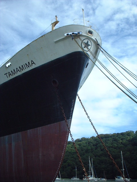
The Ukranian-crewed cargo ship, Tamamima, slowly rusting in the upper reaches of the Fal Estuary, close to the King Harry Ferry. More information on the Tamamima can be found here
While the rest of this special edition of the magazine takes to the canals and rivers of Britain, we couldn’t let the month pass without a look at the landforms that are found next to Britain’s most important waterway – one that you’re famously never more than 70 miles or so from in the UK – the sea. At nearly 20,000 miles long and formed from countless permutations of geology and topography, there’s a variety of features to see along the coastline of Britain.
Having said that, there are parts of Scotland that appear to have borrowed Nordic landforms – its north and west coast are punctuated by steep glacier-gouged fjords; each U-shaped valley terminating in sea lochs like Loch Broom by Ullapool or the glorious Loch Etive a few miles north of Oban. Although not as forbidding as their Norwegian counterparts, Scottish fjords share a heritage with the mountains of Scandinavia that goes beyond their glacial origins; they are part of the same mountain range – eroded to a fifth of its former height and torn apart by the same tectonic processes that opened up the Atlantic Ocean, while the rest of the range forms the Appalachians of the eastern USA.
At the other end of Britain, the drowned valleys or ‘rias’ of Cornwall and Devon are stunning examples of what happened when the glaciers melted. The rise in sea level – between 100-120 metres – inundated coastal valleys from Milford Haven in Wales around the coast to Southampton Water and the Solent. Among them, the Carrick Roads at Falmouth is the third deepest natural harbour in the world (after Sydney and Rio de Janeiro, since you ask), while five miles upstream and to all intents and purposes in the middle of the countryside, the channel is still deep enough to mothball container ships next to the chain-link King Harry Ferry. Despite the incongruity, like other rias – the Helford, the Fowey, the Tavy, Tamar and Dart, sylvan valleys with woods to the water’s edge and the odd bottomless boat slowly melting back into the river – the Fal maintains an air of tranquility.
Further east, Dorset’s Jurassic Coast displays a stunning set of landforms made by differential erosion; headlands of harder rock than the bays they frame, arches, sea-stacks and coves, but its most striking feature is Chesil Bank, an 18-mile long barrier beach that sweeps into the base of the Isle of Portland. It was originally described as Britain’s largest tombolo – a spit formed by refraction of currents around an island – but geomorphologists have changed their minds about that and say it only looks like one, transferring the honour further north among Shetland’s fjords – or voes – to the sandy tombolo that connects St Ninian’s Isle to the Mainland.
Snow Business
January 2013
As the mid-winter celebratory twink and glitter passes by and the season threatens to throw its worst at us in the shape of a cold snap or two, it’s a good time to consider how our landscape has been shaped by ice and snow over our long history. Most of us will be familiar with the U-shaped valleys of the Lake District, Snowdonia and the Scottish Highlands, gouged out by glaciers during the last ice age and hammered into our consciousness by geography lessons since time immemorial, but they are not the only effect of glaciation which, like love, changes everything.
Every part of Britain has been affected in some way by the various glaciations of the last two million years. When glaciers tower to 800 metres, as they did during their most recent appearance between 10 and 20,000 years ago, it should come as no surprise that the features they shape are of a similarly colossal scale, but even a periglacial climate creates huge features in the landscape and their effect upon our countryside is all around us, no matter how far north or south we are.
At 100 metres deep, the Devil’s Dyke, just north of Brighton is the deepest dry valley in the world and its creation was a consequence of what tundra does to porous rock. Situated on chalk, a rock that usually has the porosity of a sponge but which became frozen and impermeable during the last ice age, the area would nevertheless have enjoyed the briefest of Arctic summers. Warm enough, perhaps, to thaw the chalk nearest the surface, which would be sludged away by the meltwater from the snowfields, leaving frozen, impermeable chalk to be eroded by a great meltwater river.
Further north, at the boundary between the ice and tundra, huge mounds called moraines were left at the snouts of glaciers and the most impressive of these forms the Cromer Ridge in North Norfolk, a nine-mile line of hills over 300 foot-high made from clay and boulders bulldozed up from the floor of the North Sea.
But what of the land that was ground down to be eventually deposited as irregular blobs on a landscape hundreds, if not thousands, of miles away? Aside from U-shaped valleys, the most famous outcomes of glacial progress are the whale-back hills known as drumlins. Rounded hills with ‘blunt’ ends that face the origin of the glacier and a long tapered tail on the lee side, drumlins often occur in swarms and form what is termed, rather descriptively, a ‘basket of eggs topography’. There’s an excellent set of them in Ribbleshead in Yorkshire, but since there are 8350 of them in Britain, it might be worth a trudge out in the snow to find your own.